Theme


Autumn 1


The children have been looking at what are continents?, how many can they name? and how many European countries can they name. They then used maps and atlases to accurately mark country names on a map of Europe. As a class, we talked about why we originally joined the EU ( European Union). The children then worked in groups and discussed how Europe is different to the EU and why leaving the EU might cause issues and why people may want to leave the EU.
.JPG](/uploads/378/images/IMG_4537[1](1).JPG)
![IMG_4538[1].JPG](/uploads/378/images/IMG_4538[1].JPG)
.JPG](/uploads/378/images/IMG_4650[1](1).JPG)
![IMG_4652[1].JPG](/uploads/378/images/IMG_4652[1].JPG)
![IMG_4539[1].JPG](/uploads/378/images/IMG_4539[1].JPG)
![IMG_4651[1].JPG](/uploads/378/images/IMG_4651[1].JPG)
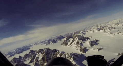
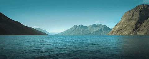
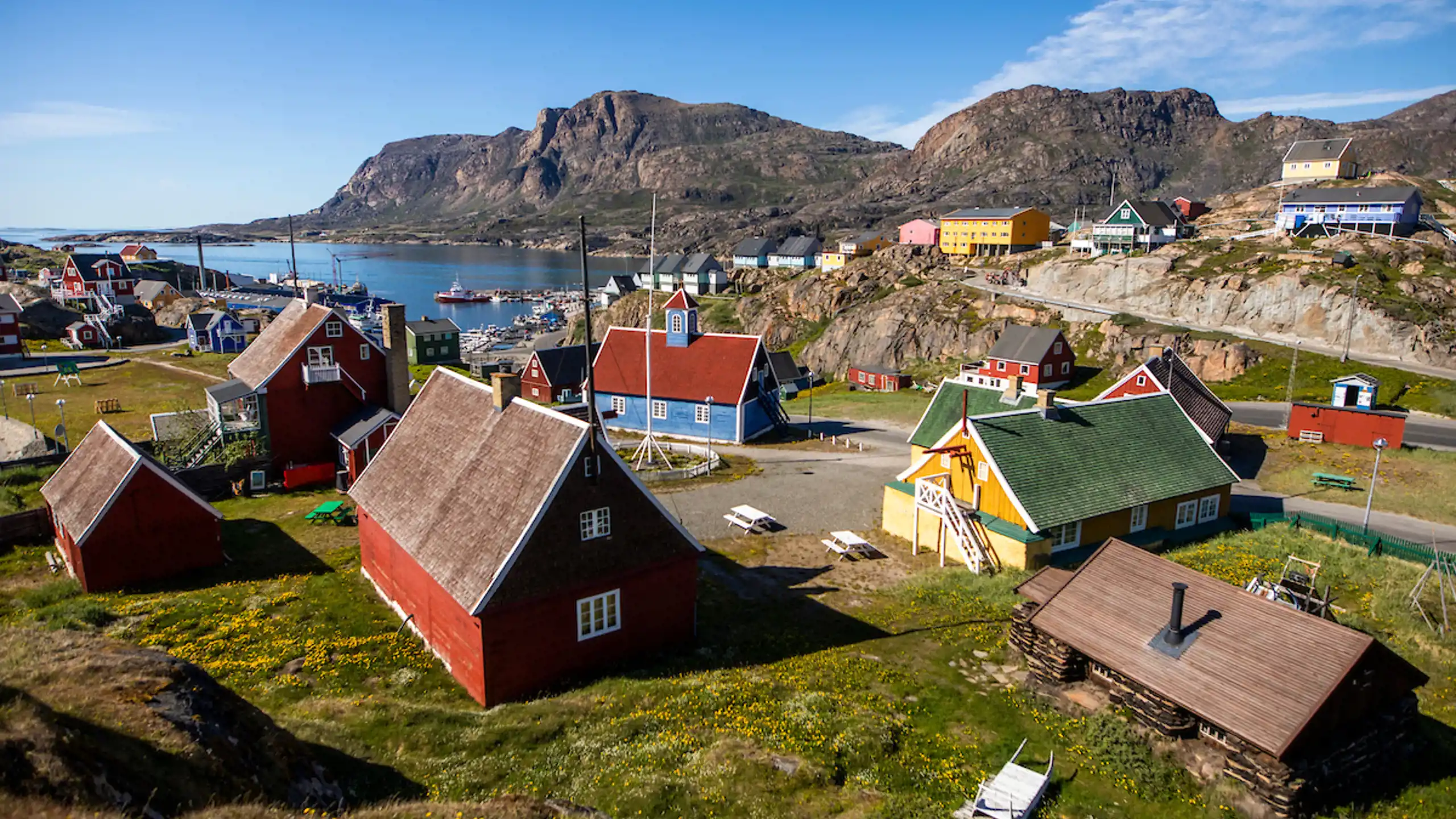
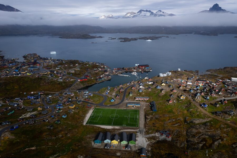
The children began to explore Greenland. They looked at the capital city and satellite image of the country. The children were given pictures of diiferent parts of Greenland and worked in groups to discuss what they might know and what they would like to find out.
Click on the link to find out more about Greenland.
Colourful Nuuk - Capital of Greenland | Guide to Greenland

.JPG](/uploads/378/images/IMG_4706[1](1).JPG)
.JPG](/uploads/378/images/IMG_4709[1](1).JPG)
![IMG_4708[1].JPG](/uploads/378/images/IMG_4708[1].JPG)
![IMG_4707[1].JPG](/uploads/378/images/IMG_4707[1].JPG)
Children used Digimaps to locate local landmarks.
Then they researched Greenland. They Describe where Greenland including:
- Hemisphere,
- which circle it is in,
- the surrounding oceans,
- which continent is it in?
On your map, label the lines of longitude and latitude.
The task was:
- Find the UK on your map.
- How many degrees north of the equator is it?
- What about Greenland?
- What other countries lie to the West and East of the UK with a similar latitude?
Then they imagined they are in the UK and you are flying south along the zero degrees of longitude (prime meridian) and began making a list of the countries they would pass over and labelled and coloured these on the map.
.JPG](/uploads/378/images/IMG_4921[1](1).JPG)
.JPG](/uploads/378/images/IMG_4919[1](1).JPG)
![IMG_4918[1].JPG](/uploads/378/images/IMG_4918[1].JPG)
![IMG_4917[1].JPG](/uploads/378/images/IMG_4917[1].JPG)

The children have been looking at the physical features of Greenland.

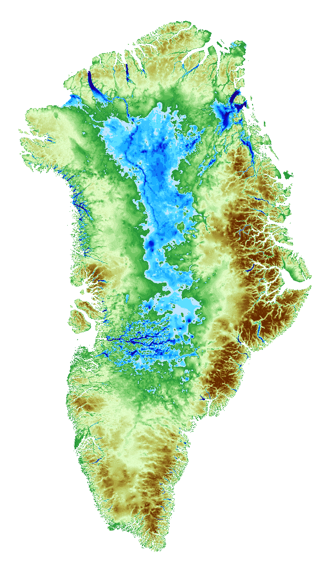
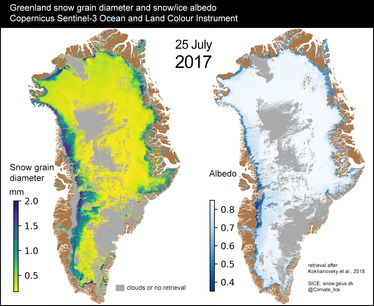
Working in groups, the children wrote down their observations of the physical features based on the relief maps.
![IMG_5119[1].JPG](/uploads/378/images/IMG_5119[1].JPG)
![IMG_5120[1].JPG](/uploads/378/images/IMG_5120[1].JPG)
![IMG_5121[1].JPG](/uploads/378/images/IMG_5121[1].JPG)
![IMG_5122[1].JPG](/uploads/378/images/IMG_5122[1].JPG)
![IMG_5123[1].JPG](/uploads/378/images/IMG_5123[1].JPG)
![IMG_5125[1].JPG](/uploads/378/images/IMG_5125[1].JPG)
13th October

Humans hurting earth
- Climate Change
- Cause: Burning fossil fuels, deforestation, and industrial emissions.
- Impact: Rising global temperatures, melting glaciers, sea level rise, and more frequent extreme weather events like hurricanes, droughts, and floods.
🐾 2. Loss of Biodiversity
- Cause: Habitat destruction, pollution, overhunting, and climate change.
- Impact: Thousands of species are endangered or extinct, disrupting ecosystems and food chains.
🌳 3. Deforestation
- Cause: Logging, agriculture, and urban expansion.
- Impact: Loss of carbon sinks, reduced oxygen production, and destruction of wildlife habitats.
🧪 4. Pollution
- Air Pollution: Causes respiratory diseases and contributes to global warming.
- Water Pollution: Harms aquatic life and contaminates drinking water.
- Soil Pollution: Reduces agricultural productivity and poisons ecosystems.
but on the other hand.....
Humans helping earth
- Environmental Conservation
- Protected Areas: National parks, wildlife reserves, and marine sanctuaries preserve ecosystems and biodiversity.
- Reforestation: Planting trees helps restore forests, absorb carbon dioxide, and support wildlife.
⚡ 2. Clean Energy Innovation
- Renewable Energy: Solar, wind, hydro, and geothermal power reduce reliance on fossil fuels.
- Energy Efficiency: Smart technologies and green buildings lower energy consumption and emissions.
🚮 3. Waste Reduction
- Recycling Programs: Reduce landfill waste and conserve resources.
- Climate Action
- Global Agreements: Treaties like the Paris Climate Accord unite countries to reduce emissions.
- Carbon Offsetting: Individuals and companies invest in projects that absorb or prevent carbon emissions.
🧠 5. Education and Awareness
- Environmental Education: Schools and campaigns teach sustainability and eco-friendly habits.
- Activism: Movements led by youth and communities push for policy change and corporate responsibility.
Autumn 2
The Maya people lived in Mesoamerica which is made up of Mexico and part of Central America.
The Maya people are remembered for amazing creations, like their spectacular buildings and beautiful objects made from jade, a rare and valuable material.
They also invented groundbreaking ideas which have helped shape the way we live our lives today. For example, it’s thought that the Maya invented the idea of?'zero'.
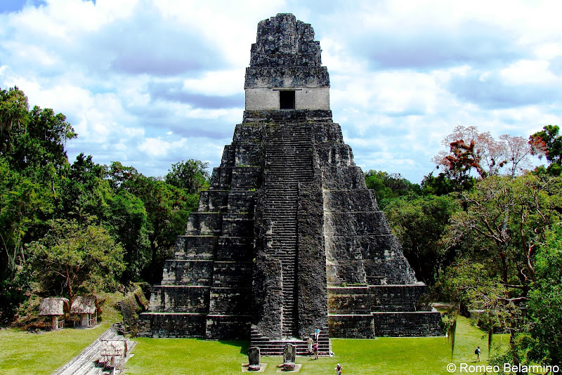
The modern name for the Maya ancient city Yax Mutal was Tikal. Tikal was home to thousands of Maya people. Some of the city's ruins still stand today, including the temple of the Great Jaguar.
The Maya civilisation survived until 1600AD when they were conquered by Spanish invaders.
Did you know....
Almost all written texts were destroyed by a Catholic priest after the Spanish conquest in the 16th century AD which is why we do not know a lot about Maya writing.
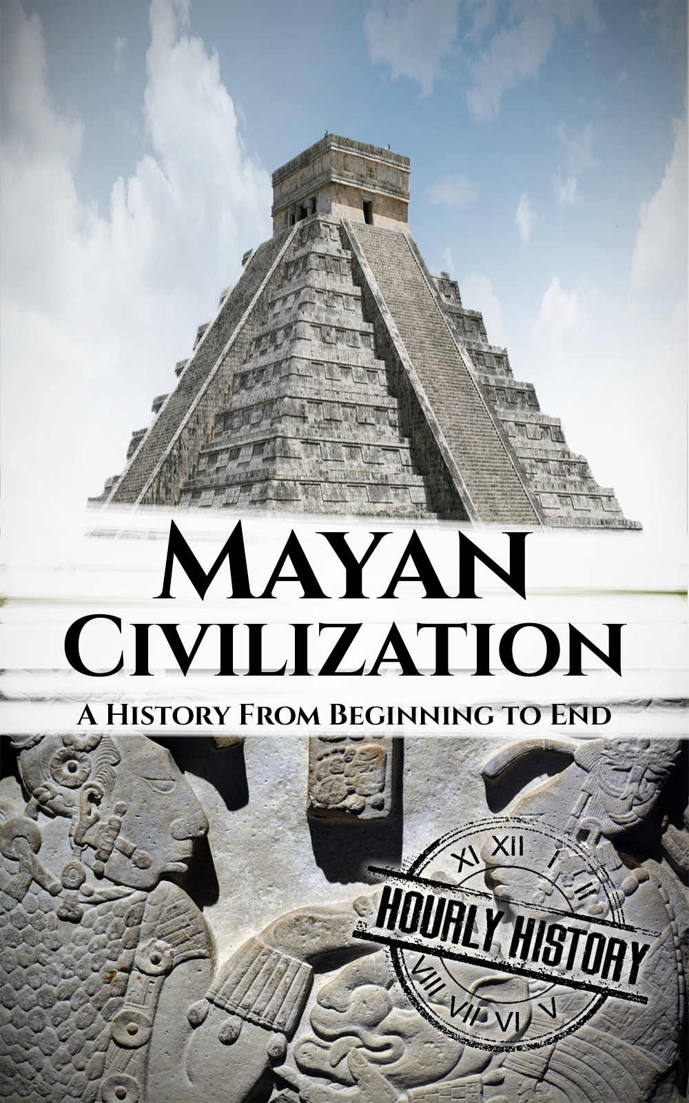
Please click on the pictures below to find out more about the Mayan Civilisation
Here are some of the artefacts that we recieved to get an feeling of what it was like living in Mayans time.
What do you think they are and how they were used.


The children discussed why did the Maya empire grow to be so successful.They then shared their thoughts with other pairs.

.JPG)
.JPG)

The children studied the artefacts.
![IMG_5595[1].JPG](/uploads/378/images/IMG_5595[1].JPG)
![IMG_5596[1].JPG](/uploads/378/images/IMG_5596[1].JPG)
![IMG_5600[1].JPG](/uploads/378/images/IMG_5600[1].JPG)
![IMG_5592[1].JPG](/uploads/378/images/IMG_5592[1].JPG)
![IMG_5598[1].JPG](/uploads/378/images/IMG_5598[1].JPG)
![IMG_5590[1].JPG](/uploads/378/images/IMG_5590[1].JPG)
![IMG_5591[1].JPG](/uploads/378/images/IMG_5591[1].JPG)

.JPG)

The child looked and discussed if the Mayams were so civilized, why then did they believe in human sacrifice.
![IMG_5742[1].JPG](/uploads/378/images/IMG_5742[1].JPG)
![IMG_5743[1].JPG](/uploads/378/images/IMG_5743[1].JPG)
![IMG_5744[1].JPG](/uploads/378/images/IMG_5744[1].JPG)
![IMG_5745[1].JPG](/uploads/378/images/IMG_5745[1].JPG)

Spring 1
![]()

Adolf Hitler was the dictator of Nazi Germany and a central figure in World War II, leading the country
into a devastating conflict that resulted in immense loss of life and widespread destruction.
United Kingdom: One of the first countries to declare war on Germany after its invasion on Poland in 1939.
UK played a crucial role in the early years of the war, particularly during the Battle of Britain.

![IMG_6057[1].JPG](/uploads/378/images/IMG_6057[1].JPG)
![IMG_6058[1].JPG](/uploads/378/images/IMG_6058[1].JPG)
![IMG_6060[1].JPG](/uploads/378/images/IMG_6060[1].JPG)
![IMG_6061[1].JPG](/uploads/378/images/IMG_6061[1].JPG)
![IMG_6063[1].JPG](/uploads/378/images/IMG_6063[1].JPG)
![IMG_6056[1].JPG](/uploads/378/images/IMG_6056[1].JPG)
![IMG_6062[1].JPG](/uploads/378/images/IMG_6062[1].JPG)
The children visited a war museum to learning more about life during the war.


The children worked with the talking partner and researched The Battle of Britain.
![IMG_6270[1].JPG](/uploads/378/images/IMG_6270[1].JPG)
![IMG_6271[1].JPG](/uploads/378/images/IMG_6271[1].JPG)
![IMG_6274[1].JPG](/uploads/378/images/IMG_6274[1].JPG)
![IMG_6272[1].JPG](/uploads/378/images/IMG_6272[1].JPG)
![IMG_6273[1].JPG](/uploads/378/images/IMG_6273[1].JPG)
The children worked in groups to find out all about The Battle of Britain
What was it?
The Battle of Britain was an important battle in World War II. After Germany and Hitler had conquered most of Europe, including France, the only major country left to fight them was Great Britain. Germany wanted to invade Great Britain, but first they needed to destroy Great Britain's Royal Air Force. The Battle of Britain was when Germany bombed Great Britain in order to try and destroy their air force and prepare for invasion.
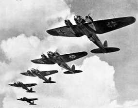
Heinkel He 111 during the Battle of Britain
The Battle of Britain started on July 10th, 1940. It lasted many months as the Germans continued to bomb Britain.
How did it get its name?
The name comes from a speech by the Prime Minister of Great Britain, Winston Churchill. After Germany had overrun France, he said that "the Battle of France is over. The Battle of Britain is about to begin."
The Battle
Germany needed to prepare for the invasion of Britain, so they first attacked towns and army defenses on the southern coast. However, they soon found that Britain's Royal Air Force was a formidable opponent. The Germans decided to focus their efforts on defeating the Royal Air Force. This meant they bombed airport runways and British radar.
![IMG_6353[1].JPG](/uploads/378/images/IMG_6353[1].JPG)
![IMG_6354[1].JPG](/uploads/378/images/IMG_6354[1].JPG)
![IMG_6355[1].JPG](/uploads/378/images/IMG_6355[1].JPG)
.JPG](/uploads/378/images/IMG_6356[1](1).JPG)
Spring 2

In this unit, the children will learn and be able to name and locate counties and cities of the United Kingdom, geographical regions and identifying human and physical characteristics, land-use patterns and understand how some of these aspects have changed over time.
Key question: What impact did WW2 have on our local area (Lancashire) and what evidence is there of this?
|
Manchester |
Burnley |
|
- Large city (Urban) - Located in Greater Manchester - Population: very large - Famous for football teams, music, shopping, and universities - Many jobs, shops, roads, and public transport - Very busy and crowded |
- Rural town - Located in Lancashire - Population: much smaller - Famous for Burnley FC, history of mills, and countryside nearby - Fewer shops and jobs - Quieter and less crowded |
Key question : Would you rather live in Burnley or Manchester? Why?
![IMG_6514[1].JPG](/uploads/378/images/IMG_6514[1].JPG)
![IMG_6515[1].JPG](/uploads/378/images/IMG_6515[1].JPG)
Summer 2
🚂 Victorian Crime and Punishment (1837–1901)
🔍 What were common crimes?
- Theft was very common, especially in crowded cities.
- Pickpocketing was often carried out by children in gangs.
- Burglary (breaking into houses) and stealing goods from factories happened frequently.
- More serious crimes included violence, poisoning and murder.
🔗 Punishments
- Prison became the main punishment during this time.
- People could still be hanged for serious crimes.
- Some criminals were sent to Australia (transportation).
- Other punishments included whipping, fines and hard labour.
⛓️ Life in Victorian Prisons
- Prisons were designed to be harsh and unpleasant to scare people away from crime.
- Prisoners had to do hard labour, such as:
- Treadmill walking
- Turning a crank
- Picking apart rope (oakum).
- Prisoners often worked in silence for long hours
👦 What about children?
- Children could be sent to adult prisons at first.
- Later, special Reformatory Schools were created for young offenders.
- However, these places were still strict and tough